Kuhstall and Schrammsteine
SAXON SWITZERLAND | Hike from Lichtenhain Waterfall to Kuhstall, Winterberg and Schrammsteine
The Schrammsteine are one of the most popular destinations in Saxon Switzerland: comprehensible, as fantastic views into the Elbe valley are linked to sporty demand. Other points of interests of your tour are, e.g. the Kuhstall, which is the second largest natural arch in the Elbe Sandstone Mountains after the Pravčická brána, and the panoramic view from the Kleiner Winterberg into the back of Saxon Switzerland called Großer Zschand.
| region | : | Kirnitzsch Valley | Schrammsteine | duration | : | 6 hours |
| highlights | : | Kuhstall - Kleiner Winterberg - Schrammsteine - Lichtenhain Waterfall | difficulty | : | hard |
detailed description | SCHRAMMSTEINE

Lichtenhain Waterfall - Kuhstall
This day hike to the cliffy and famous Schrammsteine starts in the Kirnitzsch Valley at Lichtenhain Waterfall, that is about 10 kilometers away from the spa village of Bad Schandau. At the parking you cross the Kirnitzsch on a little stone bridge and follow the path to the 20-minutes-away situated Kuhstall, which is - as already written - the second largest arch in Saxon-Bohemian Switzerland. The trail gains height very fast and as a consequence sweating cannot be prevented. Once arrived at the impressive Kuhstall you should first discover all mysteries and rock formations surrounding the arch and not till then drink a German or Bohemian beer.
We suggest stepping through the Kuhstall and following the signage to the so-called Himmelsleiter (=> engl. heavens ladder) onto the top of the world. Afterwards, you should visit a little cave called Schneiderloch at the end of the mountain - an adventure in particular for children and adults being young at heart.
Kuhstall - Winterberg - Breite Kluft
Next stage is the panoramic view near Kleiner Winterberg, wherefore you have to descend through the narrow on the left of the Kuhstall into deep forest. Now the motto is: walk! About 45 minutes you have to head for the submontane of the Kleiner Winterberg on the Fremdenweg, where you will be greeted by a five-hundred-stairs-steps.
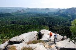
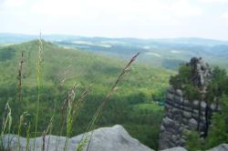
But the look-out is definitely worth the trouble: a huge greenwood is bordered by the Bärenfangwände, the Hinteres Raubschloss (a former robber-knight castle), the Thorwalder Wände and the Kuhstall. On days with clear visibility you even might be able to make out the little village of Hinterhermsdorf, which was Germanys most beautiful village in 2001.
Subsequently the hiking trail leads across a dead forest being infested by beetles, wherefor an information board has been positioned. Walking along the Reitsteig you reach the Fluchtwand and later on the Zurückesteig: there you leave the area of the Affensteine and enter that of the Schrammsteine. The first look-out, being called Breite Schlucht, provides a first view in the Elbe River valley and to the Zirkelstein, which is the tiniest Table Mountain of the entire Saxon-Bohemian Swizterland.
Breite Kluft - Schrammsteine - Schrammsteinaussicht
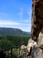
From this point on the trail runs at the very top of the Schrammsteine and straight on to today's destination: the famous Schrammsteinaussicht, one of the very best viewpoints in Elbe Sandstone Mountains. The path is very rugged, but well-walkable and secured by handrail. After an entire duration of five and a half hours, you approach the SCHRAMMSTEINAUSSICHT.
PLEASE NOTE: The Schrammsteine are not protected from direct sunlight. Due to the fact that you will reach this area in the afternoon you should protect yourself appropriate and you should have enough water at hand. The next snack is not before Lichtenhain Waterfall, which is still one and a half hours away.
Schrammsteinaussicht - Lichtenhain Waterfall
As the Schrammsteinaussicht is the last look-out for today's hike, you have to climb down the Mittelwinkel Staircase, which are some ladders and braces as they are typical for Saxon Switzerland. Along the forest road Untere Affensteinpromenade you will find your way to the Beuthenfall, that is a former tavern next to the eponymous waterfall. Here you turn right and walk about 300m parallel to the Kirnitzschtal Tramway to your starting point.
We recommend eating something at the restaurant beside Lichtenhain Waterfall, e.g. a typical marinated pot roast (sauerbraten) with bohemian dumplings or on hot days some ice-cream. Maybe you are able to watch the half-hourly event, when imperial music sounds and the waterfall is opened completely.
route in note form | SCHRAMMSTEINE
1 - Lichtenhainer Waterfall (parking) on ![]() to the Kuhstall
to the Kuhstall
2 - thorough discovering of the nearer area, afterwards further on ![]() to viewpoint Kleiner Winterberg
to viewpoint Kleiner Winterberg
3 - on Unterer Fremdenweg (![]() ) und Reitsteig (
) und Reitsteig (![]() ) to Fluchtwand -> Zurückesteig -> Breite Kluft
) to Fluchtwand -> Zurückesteig -> Breite Kluft
4 - at the very top of the Schrammsteine ![]() to Schrammsteinaussicht (today's destination)
to Schrammsteinaussicht (today's destination)
5 - descent via ladders and braces to Untere Affensteinpromenade ![]() and straight on to the Beuthenfall
and straight on to the Beuthenfall
6 - on the Kirnitzschtalstraße ![]() (parallel to tramway) turn to the right to Lichtenhain Waterfall
(parallel to tramway) turn to the right to Lichtenhain Waterfall
journey | SCHRAMMSTEINE
by bus and rail
| station: | Kirnitzschtal Lichtenhainer Wasserfall |
| lines: | bus 241 (Pirna - Bad Schandau - Lichtenhain Waterfall - Hinterhermsdorf) or Kirnitzschtal Tramway (Bad Schandau - Lichtenhain Waterfall) |
by car
First you follow route B172 to Bad Schandau town square. Then you turn to Route S165 (Kirnitzschtalstraße) and drive about seven kilometers to Lichtenhain Waterfall parking. We advise you to go by bus or tramway because there are only few parking spaces in the narrow valley near Lichtenhain Waterfall.
![]() Es gibt eine deutsche Version dieser Seite. Wechseln Sie zu "Wanderung Schrammsteine".
Es gibt eine deutsche Version dieser Seite. Wechseln Sie zu "Wanderung Schrammsteine".

